BY RICHARD MURDOCCO
During yet another historic rain event, smart phones blared overnight as the National Weather Service issued urgent emergency warning messages across Long Island’s north shore.
With rainfall falling at rates of up to four inches per hour, conditions deteriorated so quickly that meteorologists issued a Flash Flood Emergency, one of the weather service’s most extreme public warnings.
According to the agency, such alerts are used in “exceedingly rare situations when extremely heavy rain is leading to a severe threat to human life and catastrophic damage,” typically with “life-threatening water rises resulting in water rescues/evacuations.” To date, the NWS has only issued the urgent message two other times within the New York metro area, both being when the remnants of Hurricane Ida drenched New York City in 2021. Then, 14 people died as inland floodwaters rapidly rose, trapping people within basement apartments.
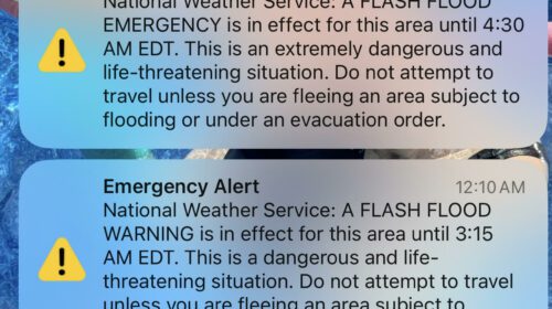
Pictured: An image of the emergency SMS push-notifications issued overnight by the National Weather Service (Source – Richard Murdocco/The Foggiest Idea)
Areas of Stony Brook and Miller Place were hardest hit by the deluge, which dumped nearly 10 inches of rainfall at rapid rates with minimal warning. In Stony Brook, the historic Mill Pond overflowed and washed away nearby Harbor Road and homes, resulting in the waterbody being completely emptied for the first time in 100 years.
In Dix Hills, a two-mile stretch of the Long Island Expressway was shut down in both directions during the storm’s peak, as was NYS Route 25. In a summary Monday afternoon, the NWS called the resulting floods “catastrophic.” Afterwards, meteorologists told Newsday reporters that the storm system had moved into the region with “a fierce intensity and then, without much warning, slowed down and stalled.”
“This storm was not predicted for Northern Suffolk,” Suffolk County Executive Ed Romaine said during a morning press conference at the scene of the pond dam collapse in Stony Brook, noting that the floods resulted in mudslides and buried cars. “When you get almost 10 inches of rain, that’s a once in a hundred-year storm. I don’t think we’re going to have to wait another 100 years. It tells you the impact climate change is having on our weather and the natural disasters we’re having.”
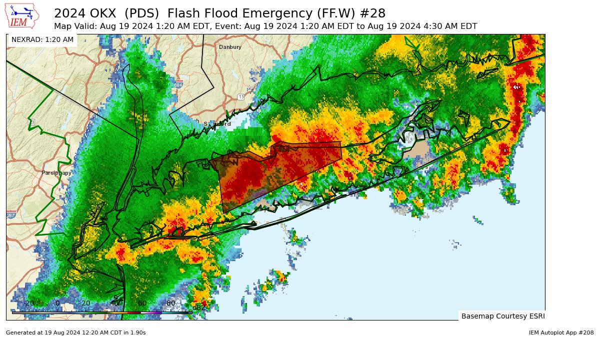
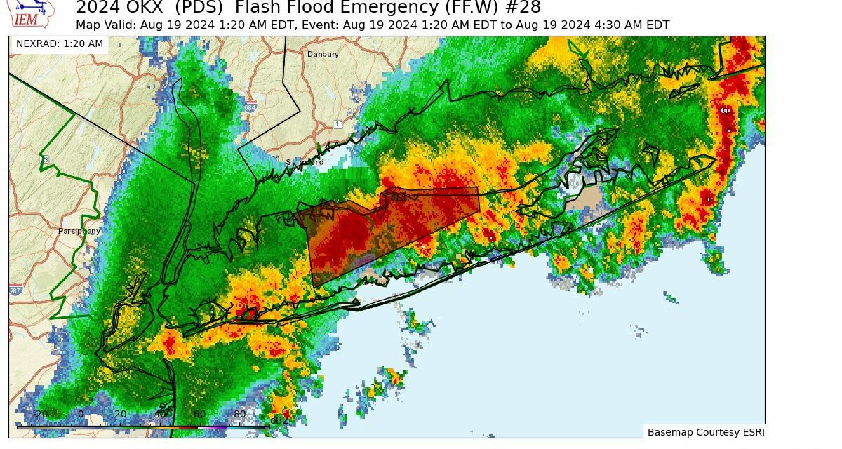
Pictured: The doppler radar signature of areas under a historic Flash Flood Emergency within a series of overnight storms that caused widespread damage across Long Island’s north shore. (Source – IEM Autopilot)
Romaine quickly issued a state of emergency declaration, which more quickly unlocks available federal and state aid for recovery. All told, officials are estimating that damages will total anywhere from at least $25 to $75 million.
As the weather becomes more turbulent , The Foggiest Idea has increasingly warned about the dangers that extreme weather poses to our region, calling for inter-municipal cooperation and enhanced communication of weather risks by government.
Just last week, TFI cautioned on the pages of Newsday that focused regional planning efforts are necessary to prepare for this new normal. “As temperatures rise and winds rage,” TFI warned, “…We must work together to ensure that words translate into action before we are hit with the next unexpected deluge.”

